The Year the Maps Changed
Chapters (75)
Cover
Title Page
This is a work of fiction. All central characters are fictional, and any resemblance to actual persons is entirely coincidental. In order to provide the story with a context, real names of places are used as well as some significant historical events. A number of high-profile people are also referred to, but there is no suggestion that the events described concerning the fictional characters ever occurred.
This fictional story takes place in the Kulin Nation and is set on the lands of the Boon Wurrung people. The Boon Wurrung are the traditional people and custodians of these lands, from the Werribee River to Wilsons Promontory. I pay respect to their elders and acknowledge this land was taken by force and that the First Nations have never ceded sovereignty to their lands and waters.
Dedication
For Mum and Dad, and Omi too.
I love you.
Epigraph
We are volcanoes.
When we women offer our experience as our truth, as human truth, all the maps change.
There are new mountains.
URSULA K. LE GUIN
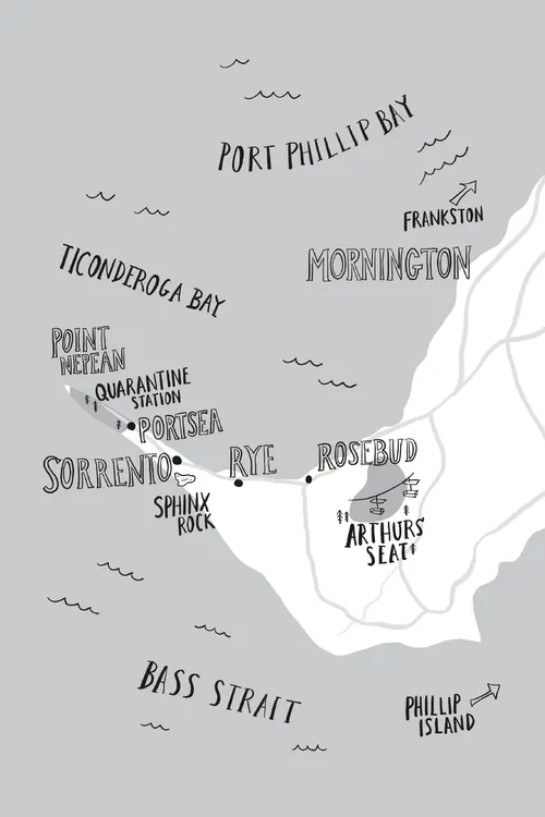
Map
Prologue
Maps lie.
Or at least, they don’t always tell the truth. They’re like us humans that way.
Mr. Khouri would say it’s because they can’t show us everything about a place or the people in it. Maps don’t tell you about the ownership, genealogy, or history of an area. A map doesn’t even really tell you where to begin or end—those ones with “Start Here” and “X Marks the Spot” are just that way in movies, or kids’ menu coloring placemats. Really it’s up to us—the people who live within the borders—to keep the truth and know the way.
And lately I’ve been thinking that it doesn’t matter so much where you end up, if you can’t remember how you got there in the first place. Like my pop would say: it’s not the destination, it’s the journey.
Remembering is like retracing my steps. There are so many different trails to this story and it’s hard to know which one to take. But I need to lay down a way to see everything that happened this past year: the war, Nora, Operation Safe Haven, and the baby we couldn’t keep.
I was eleven when everything started and twelve by the end. But that’s another way that maps don’t tell the whole truth—because it felt like the distance I traveled was a lot further than that.
1
Memories Like Mountains
Arthurs Seat is the highest point of this mountain range here. It’s named that because it looks like someplace else—it’s got nothing to do with King Arthur and the Knights of the Round Table, like I’d always hoped.